Clackamas Wetland and Beaver Habitat Restoration Project
Project Description
Bark’s programmatic partnership with Portland State University and the Forest Service, is funded through the Drinking Watershed Providers Partnership, Wilburforce Foundation, Mazamas and other foundations, and individual support! Read the Story Map about this partnership HERE.
Project goals include:
- Update wetland mapping in the Clackamas drainage through both photo interpretation and field verification
- Identify site-suitability for beaver through volunteer data collection effort.
- Estimate water storage capacity of individual wetlands through both spatial analysis and measurements in the field.
- Prioritize wetlands for future restoration projects and make recommendations, and implement these recommendations when possible.
- Increase understanding and appreciation of wetland ecosystems through free trainings, presentations, volunteer opportunities.
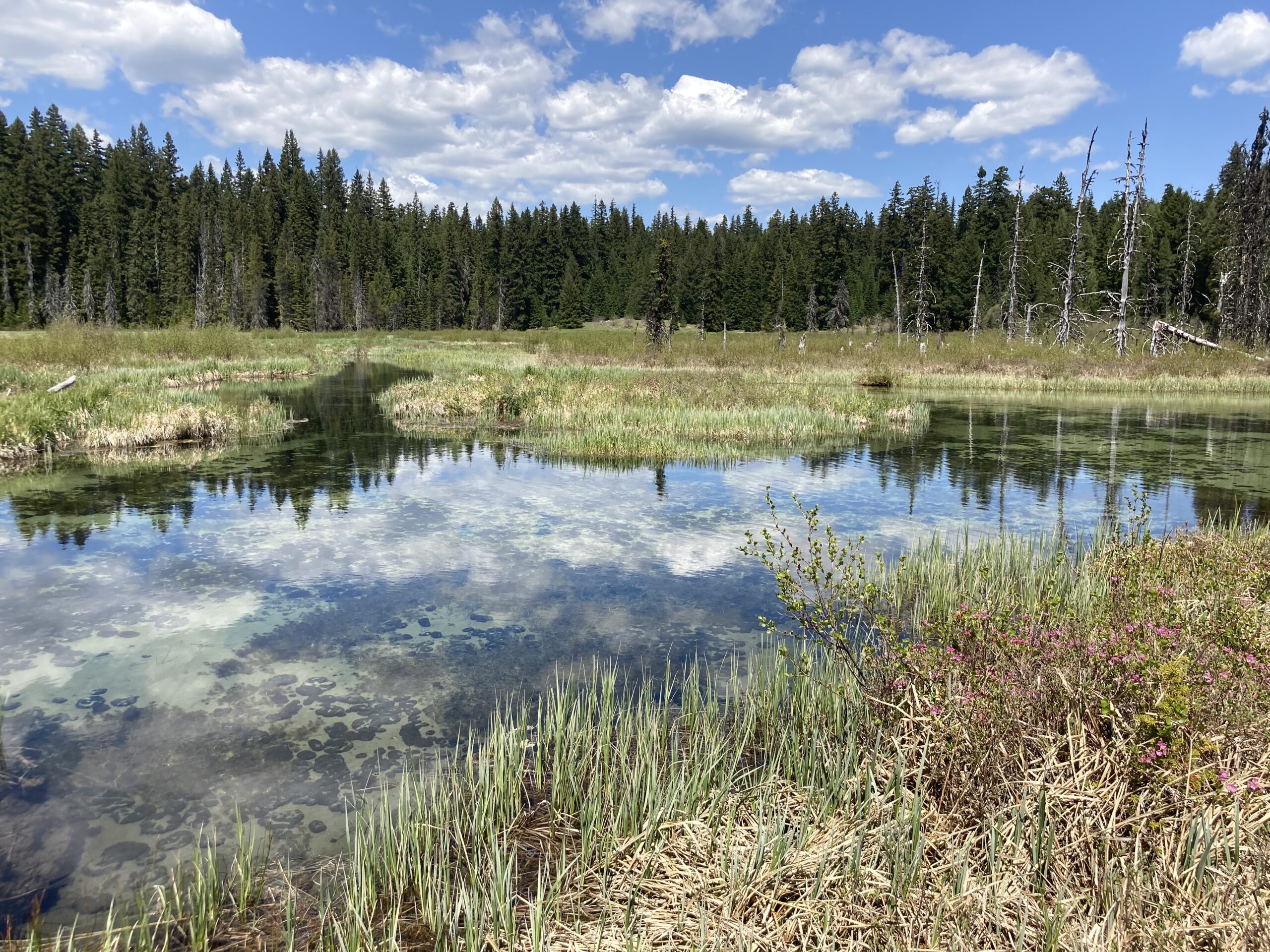
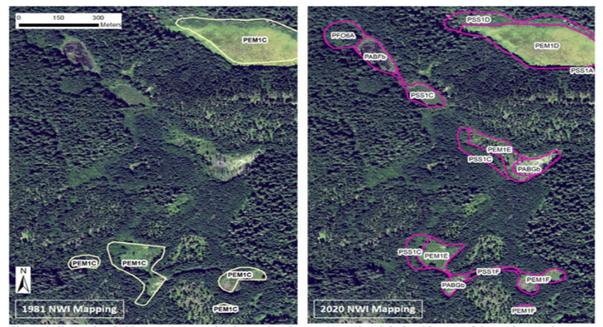
What do we mean by wetland mapping?
The Cowardin Classification System is used by the National Wetlands Inventory, a program of the US Fish and Wildlife Service, and it’s the standard classification system for wetland mapping across the U.S.
NWI mapping has been completed for most of the United States, however most of the mapping in Oregon occurred in the 1980s or earlier. Because these were based on low-resolution imagery, the current NWI does not represent the number, types or boundaries of wetlands as they exist now.
Our project on wetland and beaver restoration has the goal of updating the NWI mapping for project areas within Mt. Hood National Forest. Bark volunteers, as well as our partnership with Kyla Zaret, wetland ecologist with the Institute for Natural Resources at PSU, are integral to this multi-year program.
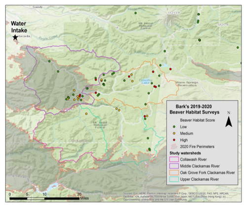
In 2019, we developed a volunteer field program to assess and prioritize habitat suitability for beaver, using a scorecard method. We developed this in communication with researchers who have done similar work up in the Methow valley in Washington, as well as more recently on the Gifford Pinchot National Forest. Our scorecard looks at variables like beaver presence (both historic and current), hydrology, vegetation, and topography.
Support this project!
- Sign up for wetland mapping and beaver habitat survey events!
- Read the Story Map about Barks partnership with Institute for Natural Resources
- Watch this 2022 presentation on the Clackamas Wetland and Beaver Habitat Restoration project.
- Learn more about how wetlands and beavers impact climate resilience in Mt. Hood National Forest.
Associated Files