Zigzag Timber Sale
As of September 2nd, 2021, the Zigzag Timber Sale has received a final decision from the Forest Service, dropping one additional unit, 33. The Draft Decision was published on September 24th, 2020. This came after Bark, 350PDX, Oregon Wild, and Oregon Physicians for Social Responsibility submitted comprehensive comments on the draft analysis, which included approximately 350 acres of logging being dropped for protection of riparian habitat, red tree voles, and other sensitive areas. The draft also included minor changes to the amount of roadbuilding, closures and decommissioning.
Following Bark’s Pre-decisional Objection meeting with the Forest Service in December 2020, the agency committed to include additional road decommissioning, and more information regarding its integration of public comment into its final decision on the Zigzag project. In addition, volunteer-led red tree vole surveys in 2021 revealed several active nests which were not mapped in the Draft Decision, but will require protection in the final project design criteria, whenever it is released.
Bark’s Concerns:
The Zigzag project area attracts thousands of visitors annually for cultural practice and free, public recreation. Areas within and surrounding the timber sale (which include the towns of Zigzag, Welches, Government Camp and Rhododendron), will be affected by any potential impacts and closures to areas like Trillium Lake, Ramona Falls, Burnt Lake, Old Maid Flat, Top Spur Trail and the Pacific Crest Trail.
The area also contains critical habitats for threatened coho and Chinook salmon and steelhead, which have seen huge recovery in recent years after proactive restoration by the USFS. Roadbuilding and logging on steep slopes above this habitat would pose a threat to salmon recovery and setback years of costly restoration efforts.
The Zigzag project includes two areas: Horseshoe and Mud Creek. The Horseshoe area spans the 1828 and 1825 road networks, within the Upper Sandy Watershed. This area accesses the Top Spur trail, Burnt Lake, Old Maid Flat, and the Pacific Crest Trail. The Mud Creek area includes the Mud Creek loop road (2656) and spurs just south of Trillium lake, and is within the Salmon River watershed.
Within the area, commercial thinning and precommercial thinning work are proposed on approximately 1,800 acres and 125 acres respectively. There is a 16 acre “regeneration harvest”, or clearcut, proposed in the Mud Creek area.
Resources for Comment-Writing
Habitats & Species
The Horseshoe area is a critical habitat for listed fish: Coho, Chinook, and Steelhead.
While there is no critical or suitable habitat for northern spotted owls within the proposed harvest units, there are approximately 6 historic territories within the project areas, and dispersal/foraging habitat exists.
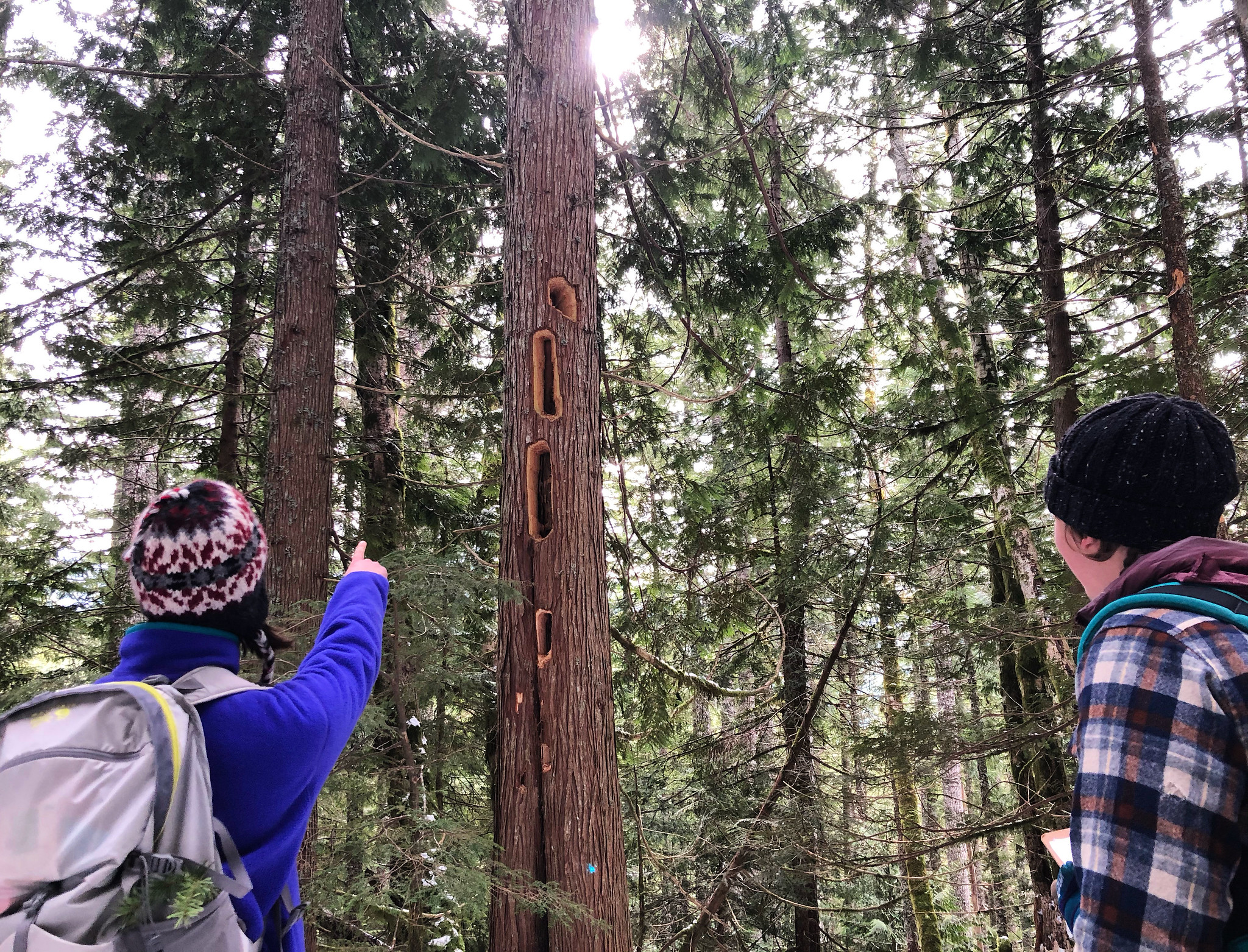
Several units contain active red tree vole nests (a protected species of arboreal rodent, which under the Northwest Forest Plan receives a 10-acre buffer if found). The Forest Service contracted climbing surveys for red tree voles in units that Bark found suitable nest trees and have dropped 2 units entirely and one partial unit based on the presence of active nests. Since then, Bark has partnered with NEST, a volunteer survey group, to locate additional red tree vole nests in more units which were not surveyed by the Forest Service.
Roads
Horseshoe: This area spans 1828 and 1825 road networks, and includes several road segments that have been recently decommissioned or identified for decommissioning previously because of their ecological impacts. The 1828-118 road (which accesses the Top Spur trail) would be closed just past where the trailhead is now. There is potential for roadwork/culvert work to be done on the Burnt Lake road.
Mud Creek: This includes the Mud Creek loop road (2656) and spurs just south of Trillium lake. The area is well roaded, but there is still some “temporary” roadbuilding proposed.
Associated Files